CROP USE MAPS
Maps of the intensity of crop use are useful for a variety of reasons. Such maps can tell scientists and farmers the density of crops planted in a particular area. Over time the maps can be used to determine changes in land use for crops. This can indicate environmental problems such as desertification or it might be the result of farmers responding to market forces by growing crops that are in demand. Rapid reduction in intensity might result from pest invasions or sudden drought. In these maps the darker colors represent greater intensity of land use for crops. These maps are provided by the Africa Data Dissemination Serviceof the USGS. |
Click below to see the crop use maps and information:
Southern Africa
Malawi
Zambia
SOUTHERN AFRICA
Click on the image to return to the gallery
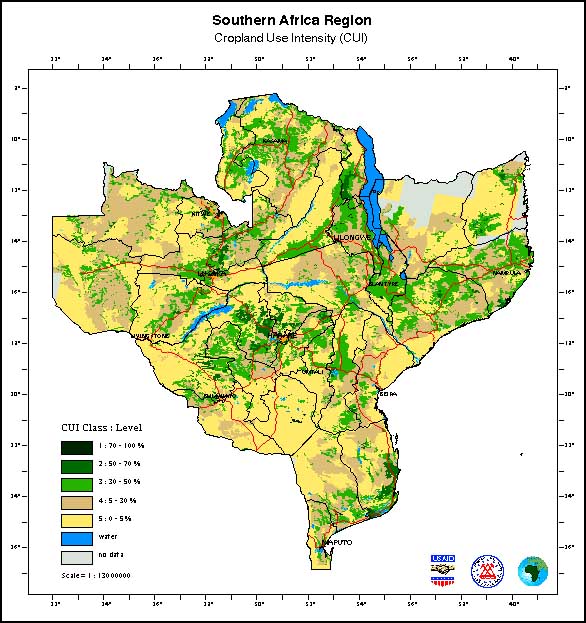
The map of Southern Africa crop use intensity shows that areas of Malawi and central Zimbabwe generally have the highest land use. Parts of western Zambia and southern Zimbabwe and Mozambique have the lowest levels of land use for farming. |
MALAWI
Click image to return to gallery
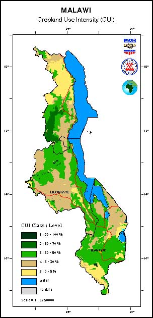
Much of Malawi is intensively farmed. The map shows only the northern Nyika Plateau area is relatively low intensity. Important agricultural export products from Malawi include tobacco, cotton and tea. However, most of the produce is from subsistence level farming and is consumed locally. |
ZAMBIA
Click image to return to gallery
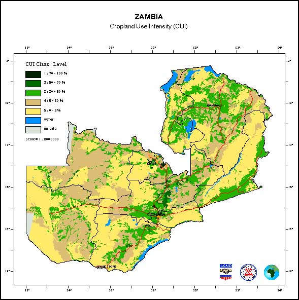
Zambia has a smaller population (and lower density) than Malawi so it has a lower intensity of land use for crops. Here we see that the central and northwest areas are the most intensively farmed but large areas especially to the west are relatively unused for farming. |
Learn about Africa crop maps
previous map
|
next maps
|
|---|


