LAKE MALAWI
Lake Malawi is the southernmost of Africa's Great Lakes. It is tenth largest lake in the world and home to one of the world's richest freshwater faunas. Biologists study its cichlid fishes but visitors enjoy the unspoiled beauty, sandy beaches and friendly people. Malawians like to call their country the "Warm Heart of Africa" and the lake is its lifeblood. |
Click below to see the Lake Malawi satellite images and information:
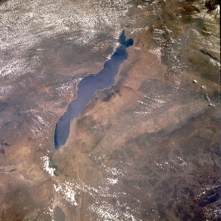
Lake Malawi from above
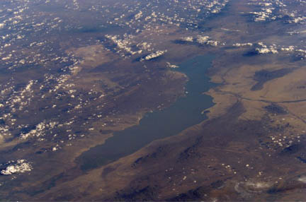
Lake Malawi north to south
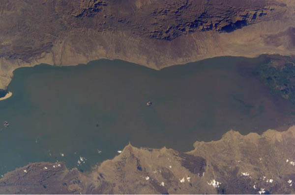
Central Lake Malawi
LAKE MALAWI
Click image to return to gallery
This view of Lake Malawi from above shows its full extent. This image is upside down compared to maps since south is toward the bottom of the picture. Tanzania is on the shore to the left, whereas the country of Malawi is to the right. Likoma Island which is closer to Tanzania but belongs to Malawi is clearly visible about halfway along the Tanzanian shoreline. |
LAKE MALAWI NORTH TO SOUTH
Click image to return to gallery
This image of Lake Malawi taken from the International Space Station is again north to south, as above, but is foreshortened due to the relatively low orbital height of the ISS. However, this angle nicely shows the rugged area of the Nyika Plateau on the northwest flank of the lake (bottom right of picture). |
CENTRAL LAKE MALAWI
Click image to return to gallery
In this image of central Lake Malawi, the Nyika Plateau is shown in sharp relief at the top right of the picture (north is to the right). |
Learn more about Lake Malawi
previous image
|
next section
|
|---|


