For three and a half centuries, from the defeat of the Spanish Armada in 1588 to World War Two, the British were the
world's dominant naval power. They used their navy to control the largest empire the world has ever known. The Royal
Navy's ruling body, the Admiralty, recognized the importance of maps to maintain supremacy and so produced many of
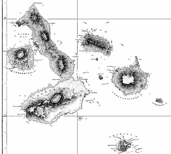
the best maps over this time. This chart resulted from Captain Robert Fitzroy's 1836 voyage in HMS Beagle,
which also took Charles Darwin to the Galapagos and so changed history. (Note: San Cristobal is omitted from the above
picture of the Admiralty chart.)
(with permission from John Woram's collection)
|


