ROADS AND FIRES
return to gallery
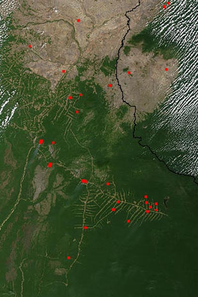
This image shows the association of road building and deforestation. The top portion of the image shows a severely degraded
region with no significant forest cover. Lower down the green area is inflitrated with roads, in a herringbone pattern. All the
fires, indicated by red dots (the actual fires are enhanced for visualization), lie along roads. The region in the lower right of
the picture is intact rainforest. (The fine white lines in the top right are clouds.)
|
Learn more about the roads and fires image
previous image
|
next section
|
|---|


