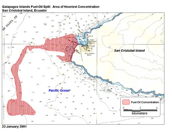
Maps are essential tools for scientists to understand the world around us. In the case of the Galapagos, scientist
used this map of the 2001 grounding of the oil tanker Jessica off San Cristobal to assess the extent of the
oil spill and its possible effects on wildlife. Luckily the bulk of the oil moved southwards, out of the way of
most of the islands to the north and west.
(This graphic was developed by the National Imagery and Mapping Agency Disaster Response Team and is reproduced with
permission.)
|


