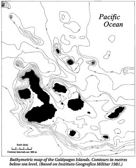
This is a bathymetric map of the seafloor around the Galapagos Islands. (Bathymetric comes from the words
bathy = deep and metric = measure.) This is useful information for scientists to understand how
currents flow around the islands and how the islands were formed. The different depths are indicated by contour
lines. Closer lines represent steeper slopes. You can see the seafloor is shallow to the center and east of the
islands — around 500 to 1500 feet. To the west, off the coast of Fernandina, the seafloor drops off sharply
to over 10,000 feet deep. Features of the seafloor are explained by how the islands formed, a consequence of
the Galapagos hotspot (See Tectonic map.)
(Map courtesy of Michael H. Jackson, Galapagos:
A Natural History Guide)
|


