MAPS OF SMALL ISLANDS
As part of its conservation policy the Ecuadorian government has placed several islands completely off-limits to visitors, accessible only to scientists and National Park personnel. Therefore these islands do not have Visitor Sites. However, they have much scientific and historical interest. |
Click below to see the small island maps and information:
Marchena
Pinta
Pinzon
MARCHENA
Click image to return to gallery
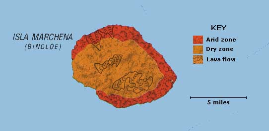
Marchena ranks as the Galapagos' seventh biggest island and the biggest island with no visitor sites. It covers an area of 50 square miles and rises to 1,125 feet above sea level. It is comprised a single volcano that remains active, the most recent eruption in 1991. Most visitors only see it if they see it if they sail around the northern part of Isabela on the way to Tower Island, its nearest neighbor about 45 miles due west. The island's name comes from a Spanish monk, Frey Antonio de Marchena. The English knew it as Bindloe, after John Bindloe — a ship's captain. Marchena was caught up in the so-called "Floreana Mystery" when in 1935 the bodies of Rudolf Lorenz and the captain of the ship on which he had set off from Floreana were found washed up on a beach. In the absence of predators and rain, the bodies were naturally mummified. |
PINTA
Click image to return to gallery
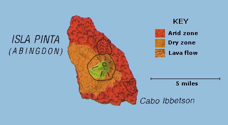
Pinta is the northernmost of the main Galapagos group (Wolf and Darwin are much further north) about 28 miles northwest of Marchena. Ninth largest of the islands, it has an area 23 square miles and is relatively rugged, reaching 2,550 feet above sea level. Pinta is famous as the home of Lonesome George, last remaining survivor of the island's race of tortoises. He was discovered in 1971 and was removed to the Charles Darwin Research Station on Santa Cruz. Scientist at CDRS have been trying for many years to breed him with other races but as yet they (or he) have had no luck. Pinta is named after one of Colombus' ships whereas the English name was in honor of Earl Abingdon. |
PINZON
Click image to return to gallery
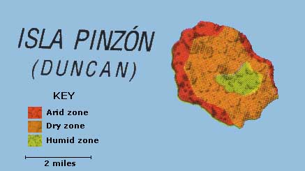
Pinzon is the twelfth biggest island inthe Galapagos, covering 7.0 square miles. It rises to 1,502 feet. Its official name comes from the two brothers who captained Colombus' ships, the Pinta and Niña. The English called it Duncan after a naval admiral. This marks the geographical center of the Galapagos Islands so it is surprising that none of the Galapagos' two main tree species do not occur on the island. In the humid zone a unique species of the daisy tree (Scalesia sp.) is found. Pinzon supports its own unique race of Galapagos tortoise, which appears to be in good shape despite predation of hatchlings by rats preventing growth of the population. Reintroduction of young tortoises from the breeding program at the Charles Darwin Research Station has resulted in restoration of breeding there and hopefully the continuation of the tortoise for the indefinite future. |
Learn more about small islands
previous map
|
next map
|
|---|


