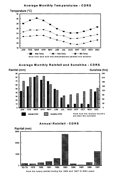
This climate chart shows rainfall and temperature on Santa Cruz Island in the Galapagos. Sea and air temperatures
are parallel (top chart), although the water temperatures are consistently lower. This is caused by the Humboldt
Current, a cool ocean current that originates in Antarctica and follows the west coast of South America all the
way to the Galapagos. Rainfall is heaviest from January to May, but this is also when it's sunnier. This is
because the second half of the year is marked by the garúa, a dense mist that envelopes the
islands. The rainfall peaks in 1983 and 1987 (bottom) were caused by El Niño events. The most recent and
most severe El Niño was in 1999, comparable to 1983.
(Chart courtesy of Michael H. Jackson, Galapagos: A Natural History
Guide)
|

